STEPS Forward · British Columbia
Mapping Student Diversity
Mapping Student Diversity was a project conducted for STEPS Forward (steps-forward.org), an inclusive post-secondary education facilitation organization in British Columbia. The map links relevant statistics about partnered institutions to their point on the map.
The map has proven to be a powerful tool for policy change, educating the public, and identifying potential barriers to accessibility. The map has over 24,000 views and has been received extremely positively by both STEPS Forward and the public.
Select the map to open its interactive version.
University of Victoria
UVIC Accessibility Map
A real-time 3D digital twin of campus that turns user-submitted reports into live building accessibility feedback.
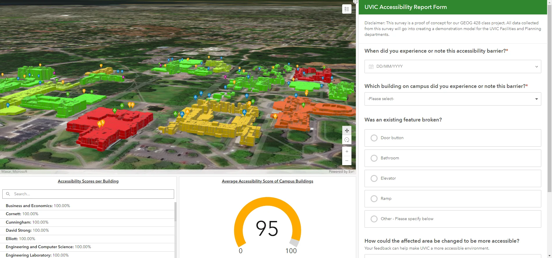
A proof-of-concept dashboard for UVIC Facilities and Planning, pairing building-level accessibility scores with a public reporting form.
Victoria Community Social Planning Council
Community Mapping Atlas
A custom Leaflet-based mapping platform built for the Community Social Planning Council, paired with an admin tool for managing layer visibility and symbology.
Community buy-in has been strong, with more datasets planned in the coming months. Phase 2 begins this July, splitting the interface into separate community-project and internal-project views.
Symbology is still being refined by the client; the underlying layer and admin tools are fully in place.
Union of BC Municipalities
Complete Communities Analysis
A 15-minute-walk accessibility analysis conducted under a Union of BC Municipalities contract, measuring how many households can reach everyday community indicators — grocery stores, parks, post offices, and more — on foot.
Over 60 maps were generated, several combined into composite visualizations. A custom ArcGIS Python tool was also built around a reusable network analysis file, enabling rapid re-simulation at no ongoing credit cost.
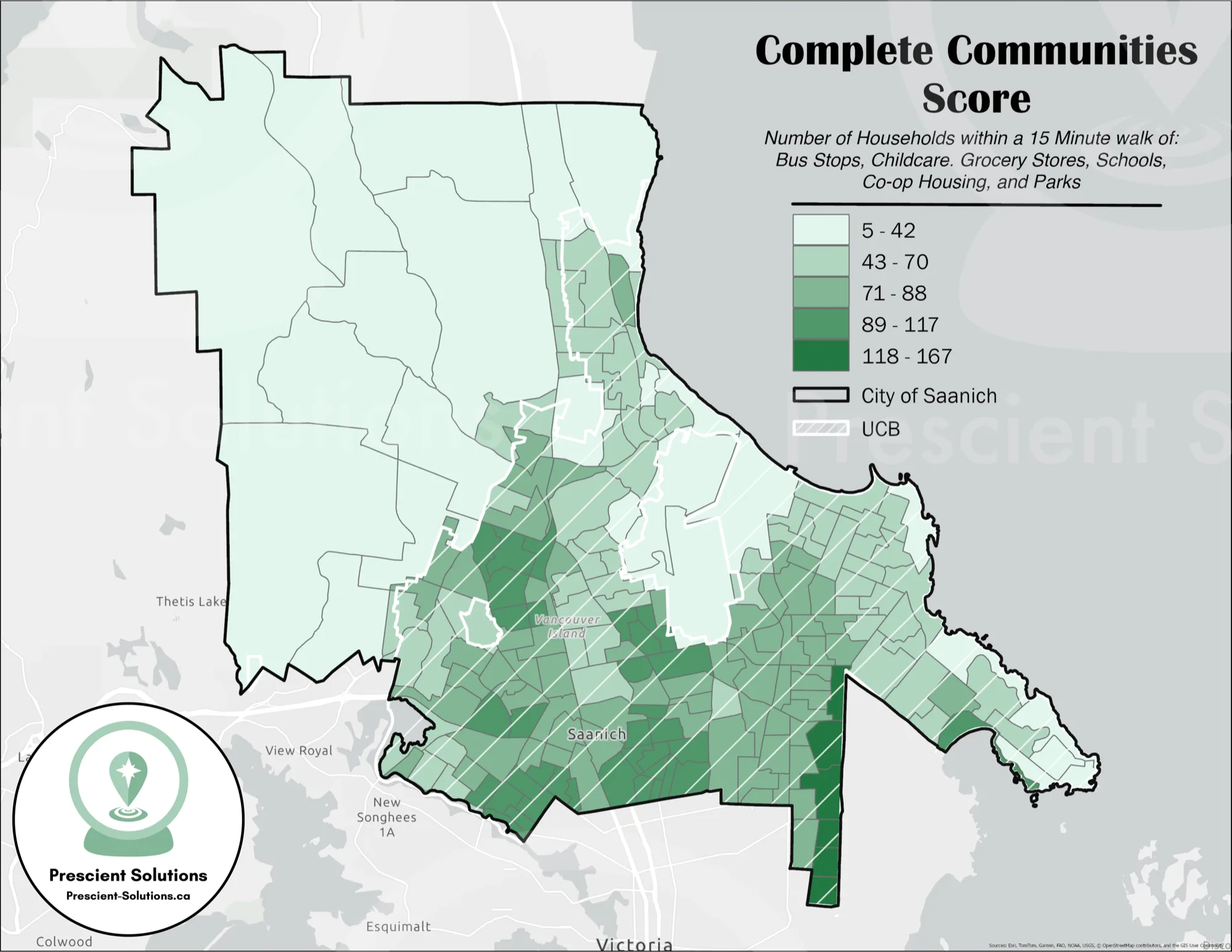
One composite visualization from the 60+ maps produced for this analysis.
Community Futures British Columbia
Community Futures Geoaccessibility Analysis
A Geoaccessibility analysis for Community Futures British Columbia, a non-profit supporting small businesses, focused on their Entrepreneurs with Disabilities and PRIDE in Entrepreneurship programs.
The analysis measured how accessible each program and office is, factoring in internet connectivity, travel times, and the presence of LGBTQ+ safe spaces. Full client results are confidential; the drive-time map below reflects one piece of the broader analysis.
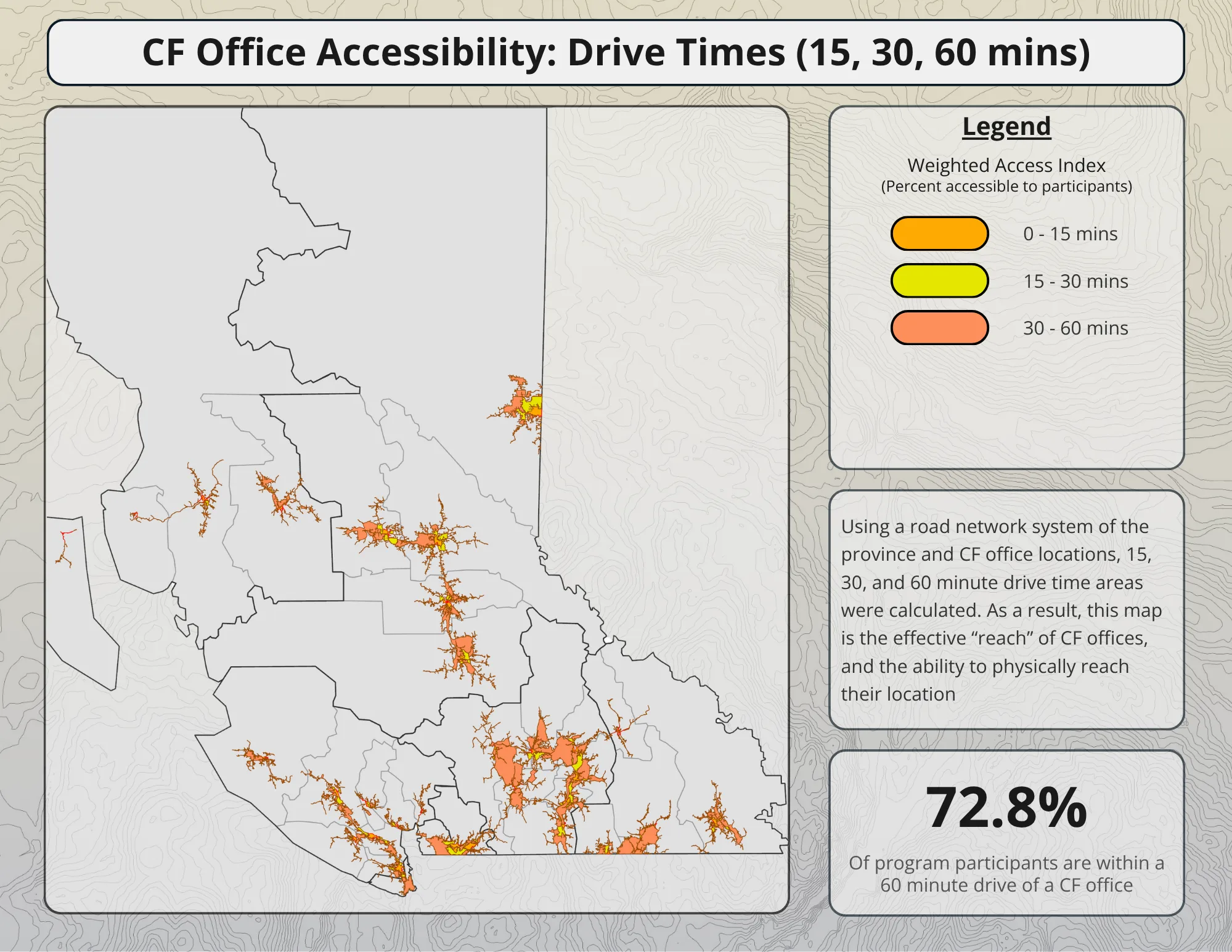
Office drive-time coverage — one supporting figure from a larger, confidential analysis.
Community Social Planning Council
2025 Point in Time Count — Routes
Identified and Mapped 29 routes to be covered in the 2025 PIT Homelessness Count for the Community Social Planning Council.
Maps were given to volunteers to walk or drive - using route analysis and optimization tools, the most efficient routes were used to reduce overall time commitments of volunteers.
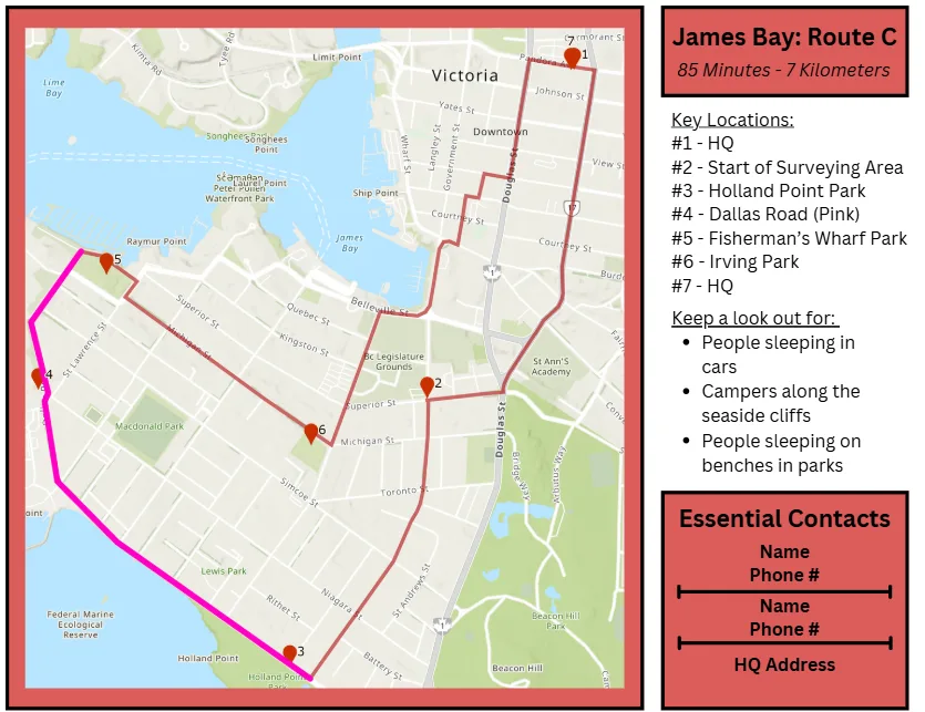
One of 29 printed route maps produced for count volunteers.
Victoria, British Columbia
Senior Accessibility Index
Using open source City of Victoria Data the following datasets were layered to create an index of accessibility:
- Accessible parking
- Curb drops
- Voice-enabled intersections
This index was overlayed onto a 3D extrusion of the region representing population of Seniors.
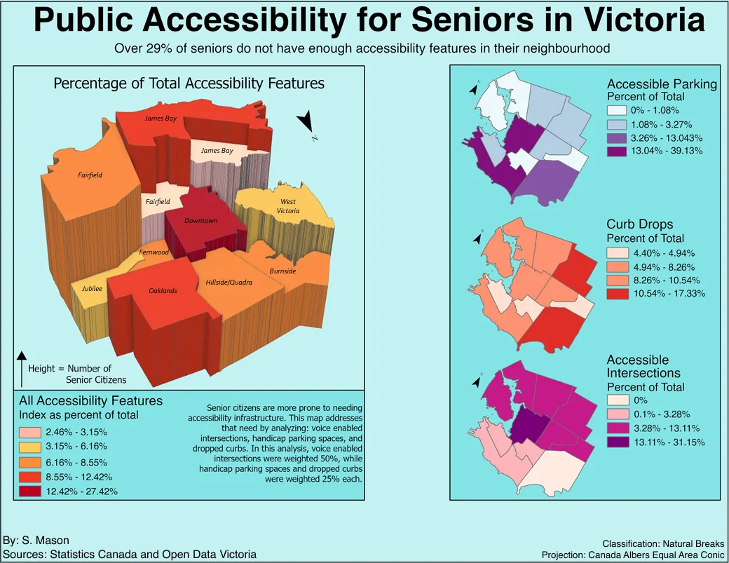
Neighbourhood accessibility index weighting voice-enabled intersections at 50%, with parking and curb drops at 25% each.